


Flyover Country - offline flight tracking

وصف لـFlyover Country - offline flight tracking
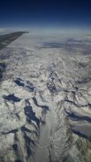
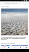
The window is the best kind of in-flight entertainment. Track your flight with GPS - discover the world below with offline maps and POI.
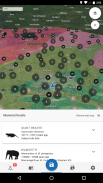
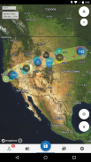
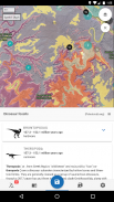
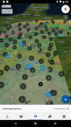
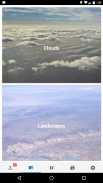
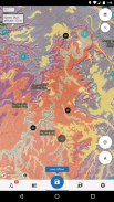
Learn about the world along the path of your flight, hike, or road trip with GPS tracking. Offline geologic maps and interactive points of interest reveal the locations of fossils and georeferenced Wikipedia articles visible from your airplane window seat, road trip, or hiking trail vista.
Follow Flyover Country for updates and photos from the sky!
https://www.facebook.com/flyovercountryapp/
https://twitter.com/flyovergeo
https://www.instagram.com/flyovergeo/
Flyover Country is a National Science Foundation-funded offline mobile app for geoscience outreach and data discovery. The app exposes interactive geologic maps from Macrostrat.org, fossil localities from Neotomadb.org and Paleobiodb.org, Wikipedia articles, offline base maps, and the user’s current GPS determined location, altitude, speed, and heading. The app analyzes a given flight path and caches relevant map data and points of interest (POI), and displays these data during the flight, without in-flight wifi. By downloading only the data relevant to a particular flight path, cache sizes remain reasonable, allowing for a robust experience without an internet connection.
Flyover Country is not limited to the window seat of airplanes. It is also ideal for road trips, hiking, and other outdoor activities such as field trips and geologic fieldwork.
**GPS functionality is only possible from the window seat and GPS reception quality varies by device/conditions**
نافذة هو أفضل نوع من الترفيه على متن الطائرة. تتبع رحلتك مع GPS - اكتشف العالم أدناه مع الخرائط دون اتصال وPOI.
تعرف على العالم على طريق رحلة طيران، رفع أسعار الفائدة، أو رحلة على الطريق مع تتبع GPS. حاليا الخرائط الجيولوجية ونقاط تفاعلية ذات الاهتمام تكشف عن مواقع للحفريات وجغرافيا مقالات ويكيبيديا مرئية من مقعدك طائرة النافذة، رحلة على الطريق، أو المشي لمسافات طويلة درب فيستا.
اتبع جسر البلد للحصول على التحديثات والصور من السماء!
https://www.facebook.com/flyovercountryapp/
https://twitter.com/flyovergeo
https://www.instagram.com/flyovergeo/
جسر البلد هو التطبيق حاليا المحمول تموله مؤسسة العلوم الوطنية للتوعية علوم الأرض واكتشاف البيانات. التطبيق يعرض الخرائط الجيولوجية التفاعلية من Macrostrat.org والمحليات الأحفوري من Neotomadb.org وPaleobiodb.org، مقالات ويكيبيديا، قاعدة الخرائط حاليا، وGPS الحالي للمستخدم تحديد موقع والارتفاع والسرعة والعنوان. التطبيق يحلل مسار رحلة معين، وتخزين البيانات والنقاط المثيرة للاهتمام (POI) خريطة ذات الصلة، ويعرض هذه البيانات خلال الرحلة، دون واي فاي على متن الطائرة. عن طريق تحميل فقط البيانات ذات الصلة إلى مسار رحلة معين، لا تزال أحجام مخبأ معقولة، مما يسمح لتجربة قوية دون اتصال بالإنترنت.
جسر البلد لا يقتصر على مقعد النافذة من الطائرات. كما أنها مثالية للرحلات الطريق، والمشي، وأنشطة أخرى في الهواء الطلق مثل الرحلات الميدانية والعمل الميداني الجيولوجي.
** وظائف GPS ليست ممكنة إلا من مقعد النافذة واستقبال GPS الجودة تختلف من جهاز / الشروط **


